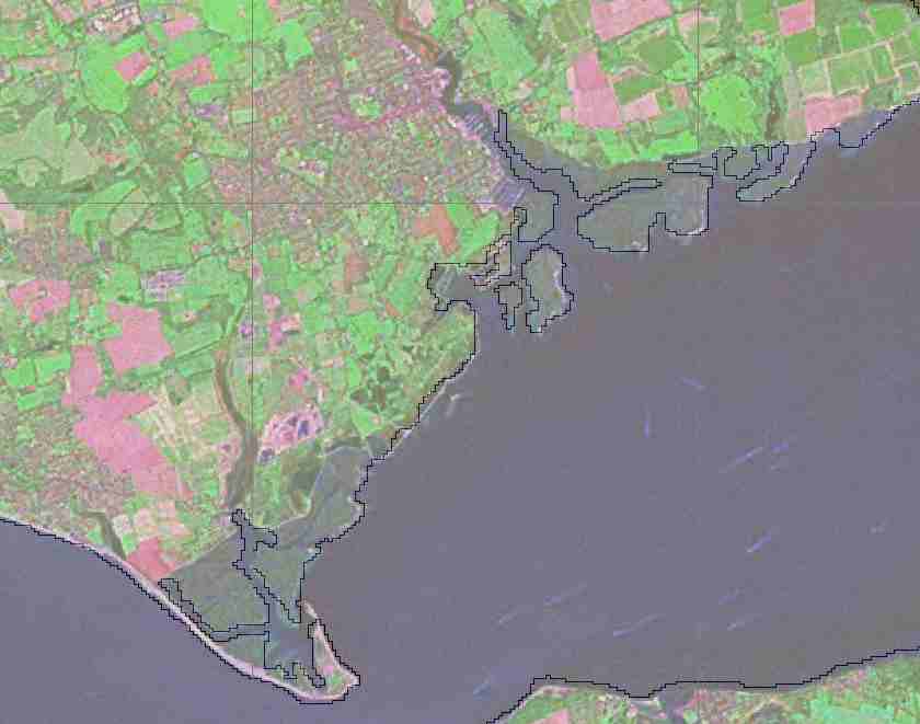
Below are two images obtained by overlaying SRTM Water Body Data (SWBD), in ESRI Shapefile form ( marked as a black line on the image) over a MrSid format Landsat photo.
The area concerned is the Solent, on the south coast of the United Kingdom.
In the image above, which is of the Lymington Estuary, and Hurst Spit, you can see that a number of areas which are actually tidal mudflats, and technically not land have been included within the shapefile for the land area of Sourghern England.
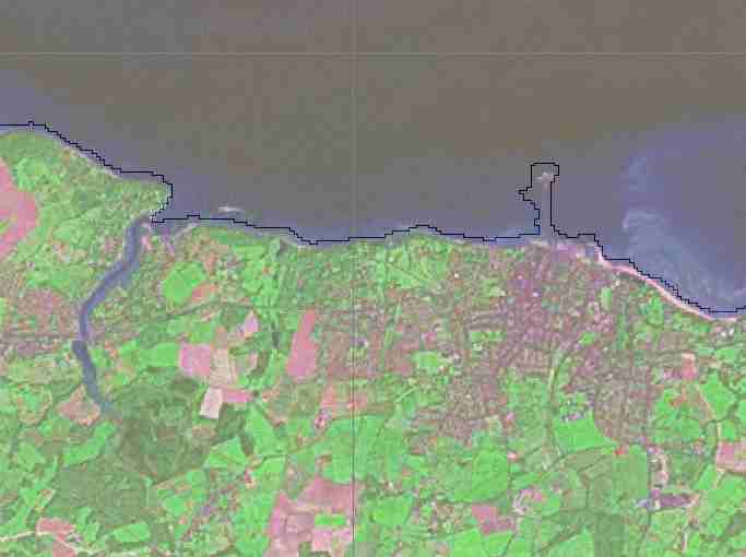
In the image above, which os of Ryde on teh Isle of Wight, the thin rectangle pointing towards the top of the picture which is shown in the shapefile as within the landmass of the Isle of Wight, is in fact a pier, and is no where near as wide as that shown in the shapefile.